
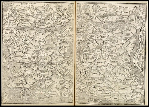
World Map (1491 edition)
"[T]the world map in the Rudimentum emphasizes the inhabited lands and pictures them as a circle surrounded by an ocean sea. Inland waters divide the ecumene into the three usual continents, each of which is labeled on the Lubeck map: Asia at the top, with the lettering outside of the circle while Europe and Africa have their names given just below the diameter where Asia ends. Paradise is located in the far east, with the four rivers issuing forth from the Garden of Eden and flowing through the lands of the earth. The Holy Land is in the center of the map with the Pillars of Hercules at the bottom.
The map seems to focus on the large continental divisions rather than on the exact geographical relationship between places. Thus the cartographer wanted the readers to know that Alexandria was in Africa, Persia was in Asia, and Venice belonged to Europe, rather than to give the precise location of each place. The placement of countries within their respective division of the world often seems to be based on other factors than distance and direction. Thus Rome is placed near the center of Europe, and Carthage occupies the similar position of honor in Africa.
The inclusion of places from Biblical history, classical times, and mythology emphasize that the function of the map was not to provide a picture of the world as it was in 1475. Rather the map presented an interesting view of the world with some essential things that a beginning student should know about it. The time did not matter. Thus places from different eras, real and mythological, were placed side by side. The map, like most of the other illustrations in the book, was a teaching aide, presenting basic information in graphic form." [source]
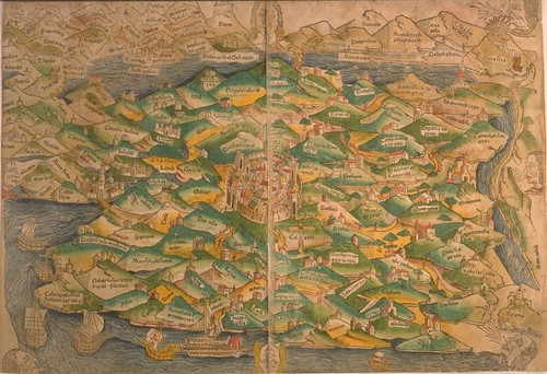
Holy Land maps of 1491 and (I think) 1475 respectively.
"This 1475 map of the Holy Land is regarded as the first modern printed map because it is not derived from a classical source (Ptolemy), nor is it in the circular schematic format characteristic of medieval maps. However, it retains two attributes of earlier maps: it is "oriented" with east at the top, and Jerusalem is at the center. The geographic information is taken largely from a now lost manuscript map made two centuries earlier by a Dominican pilgrim, Burchard of Mt. Sion. In this bird's-eye view, topographic features are portrayed with reasonable accuracy, and cities and regions are depicted as stylized hills. [source]
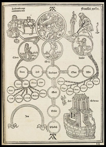
The genealogical tree of Noah
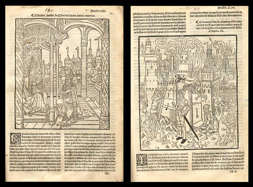
Charlemagne, Imperator Romanorum, with the Pope;
AND plundering of a castle.
AND plundering of a castle.
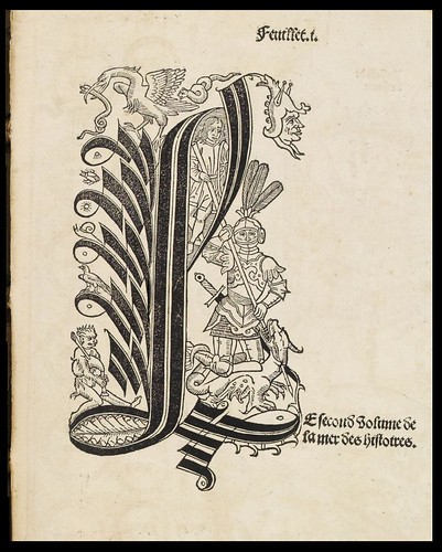
'Rudimentum Novitiorum' (Handbook for Beginners) was first published in Lübeck in 1475. It is an encyclopaedic world history based on medieval theology "derived from the Bible, the Church Fathers, pagan mythology and compilations such as that of Vincent of Beauvais, offering the basics of historical knowledge to young clerics. For the chronological arrangement use has been made of genealogical charts which are illustrated with portraits and scenes, including the first printed map of the world."
The author of the original incunabulum remains anonymous and the work achieved a wider popularity after it was translated into French (as: 'La Mer des Histoires'; The Sea of Stories) and published by Pierre Le Rouge and Guillaume le Bret in 1488/1491. Seven subsequent folio editions were released before 1555.
The eccentric presentation of religious and mythological history combined with geographical relationships of varying accuracy and importance in a visual format make these medieval maps particularly fascinating. It is well worth looking closely either in the large format (click on the images above) or via the zoom interface as below.
The two black and white maps, figural lettrine and Noah genealogy illustrations were all spliced together from up to twenty five screencaps each (spot cleaned a little). Unfortunately there doesn't appear to be any other illustrations from these exceedingly rare incunabula available online.
- The images come from the Paulus Swaen map site via Map History.
- Information from Newberry Library, (image 3).
- The woodcuts featuring Charlemagne and the castle are from Oldmasterprint.
- The colour map of the Holy Land is from the University of Maine (number 10).


No comments:
Post a Comment