'Kitāb Gharāʾib al-funūn wa-mulaḥ al-ʿuyūn'
(The Book of Curiosities of the Sciences and Marvels for the Eyes)
(The Book of Curiosities of the Sciences and Marvels for the Eyes)

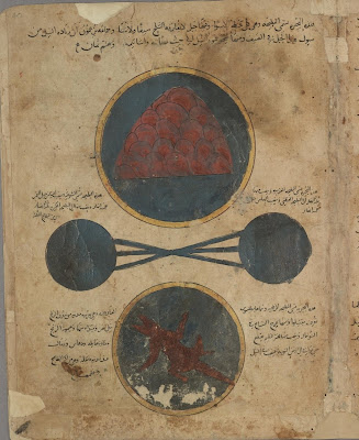
Diagram of the Encompassing Sphere or Universe [pdf legend]
{Looks like this link won't work because of a session timer - seems you have to
click on the link below each map at the site (9 pages of thumbnails)}
{Looks like this link won't work because of a session timer - seems you have to
click on the link below each map at the site (9 pages of thumbnails)}

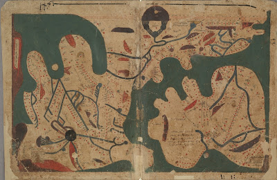
[The oldest extant] Rectangular Map of the World

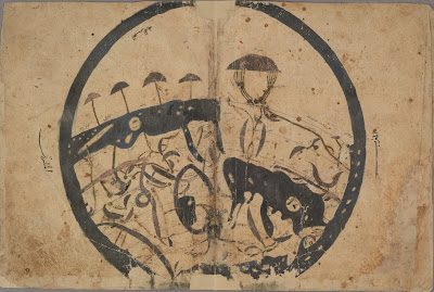
Circular World Map

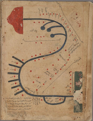
Sicily Map

Sources of Nile

Diagram of Winds
{from the chapter, 'On the blowing of winds, earthquakes and tremors'}
{from the chapter, 'On the blowing of winds, earthquakes and tremors'}

Tigris Map

Indus Map

Indian Ocean Map

Mahdiyah Map (Tunisia)
(this picture has been turned 90 degrees)
(this picture has been turned 90 degrees)

Mediterranean Map

Caspian Sea Map

Illustration of a Waq-Waq Tree
"The Waq Waq are mythical lands, associated with trees bearing humanoid fruits, which were sometimes located in Africa and sometimes in the eastern Indian Ocean."The Bodleian Library at the University of Oxford has launched a fascinating and detailed website presentation of 'The Book of Curiosities'.
Composed in Egypt in the first half of the 11th century, this recently discovered 12th/13th century cosmographical manuscript contains highly unique celestial and terrestrial maps, including the first known rectangular map of the world produced before the renaissance [I believe this has the first known map reference to England: 'Angle Terre']. The geographical references are based largely on the first century work of Ptolemy but the manuscript contains previously unknown distinct cartographic features.
In conjunction with the maps, the text provides insight into the customs and beliefs of the people and details about the commerce and trade routes in the Islamic Empire just prior to the start of the Crusades.
'The Book of Curiosities' is actually divided between 2 books (the universe and earth), and at the time of its purchase by the Bodleian in 2002 it was described as the most important Islamic scientific manuscript to have come onto the market in the last century. The whole of book 2 (earth) and parts of book 1 are presented in high resolution format with mouseover translations, arabic and english pop-up transcriptions as well as footnotes and map legends. I spent more than an hour just browsing around before downloading some sample images.
All of the maps (except the one I rotated) have north at the bottom. Why?
See also: cartography / Arabic.


No comments:
Post a Comment